Property Record
720 Dacula Rd, Dacula, GA 30019


Property Detail
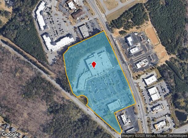
720 Dacula Rd
Atlanta-Sandy Springs-Roswell, GA
Dacula
5-273-003
DACULA VILLAGE SHOPPING CENTER
Regionalshoppingcenterormallwithanchorstore
Gwinnett
X
Georgia
13135C0062G
273
2025
10.01 AC
2025
Suwanee/Buford
050627
Atlanta
69,901 SF
NEARBY LISTINGS FOR SALE OR LEASE
DEMOGRAPHICS near 720 Dacula Rd
1 mile
3 mile
5 mile
2024 Total Population
6,870
47,370
127,996
2029 Population
7,292
49,879
135,121
Pop Growth 2024-2029
+ 6.14%
+ 5.30%
+ 5.57%
Average Age
37
37
37
2024 Total Households
2,062
14,410
38,837
HH Growth 2024-2029
+ 6.21%
+ 5.32%
+ 5.75%
Median Household Inc
$116,264
$97,861
$92,818
Avg Household Size
3.30
3.20
3.20
2024 Avg HH Vehicles
2.00
2.00
2.00
Median Home Value
$300,382
$294,214
$307,286
Median Year Built
2005
2002
2001
Nearby Places
Map Layers
Map Styles
 Street
 Aerial
Transit
 Traffic
 Biking
Places
Listings with unknown addresses are not visible on the map
- Restaurants
- Banks
- Shops
- Fitness
- Groceries
SALE & LEASE HISTORY
LISTING DATE
SALE/LEASE

Jan 15, 2019
For Lease
Nearby Properties
Address
Land Use
TOTAL SIZE
Lot Size
Zoning
Address
Land Use
TOTAL SIZE
Lot Size
Zoning
2,260,742 SF
285.40 AC
M1
Address
Land Use
TOTAL SIZE
Lot Size
Zoning
240,800 SF
28.74 AC
M1
Address
Land Use
TOTAL SIZE
Lot Size
Zoning
250,960 SF
17.55 AC
OI
Address
Land Use
TOTAL SIZE
Lot Size
Zoning
101,343 SF
44.33 AC
R1400
Address
Land Use
TOTAL SIZE
Lot Size
Zoning
204,895 SF
26.89 AC
R1200
Address
Land Use
TOTAL SIZE
Lot Size
Zoning
149,440 SF
28.41 AC
M1
Address
Land Use
TOTAL SIZE
Lot Size
Zoning
178,635 SF
28.77 AC
R1200
Address
Land Use
TOTAL SIZE
Lot Size
Zoning
124,425 SF
20.73 AC
RA200
Address
Land Use
TOTAL SIZE
Lot Size
Zoning
140,809 SF
8.97 AC
RM13
Address
Land Use
TOTAL SIZE
Lot Size
Zoning
310,027 SF
18.54 AC
M1
Address
Land Use
TOTAL SIZE
Lot Size
Zoning
393,811 SF
66.81 AC
M1
Address
Land Use
TOTAL SIZE
Lot Size
Zoning
164,850 SF
14.45 AC
M1
Address
Land Use
TOTAL SIZE
Lot Size
Zoning
327,884 SF
19 AC
M1
Address
Land Use
TOTAL SIZE
Lot Size
Zoning
179,065 SF
24 AC
M1
Address
Land Use
TOTAL SIZE
Lot Size
Zoning
160,446 SF
12 AC
GOV
Address
Land Use
TOTAL SIZE
Lot Size
Zoning
110,356 SF
20.42 AC
RA200
Address
Land Use
TOTAL SIZE
Lot Size
Zoning
97,824 SF
13.71 AC
M1
Address
Land Use
TOTAL SIZE
Lot Size
Zoning
61,686 SF
10 AC
R1400
Address
Land Use
TOTAL SIZE
Lot Size
Zoning
102,618 SF
18 AC
R1200
Address
Land Use
TOTAL SIZE
Lot Size
Zoning
275,000 SF
19.84 AC
M1
Address
Land Use
TOTAL SIZE
Lot Size
Zoning
4,588 SF
109.24 AC
RZT
Address
Land Use
TOTAL SIZE
Lot Size
Zoning
143,845 SF
31.36 AC
RA200
Address
Land Use
TOTAL SIZE
Lot Size
Zoning
99,516 SF
10.83 AC
C3
Address
Land Use
TOTAL SIZE
Lot Size
Zoning
73.79 AC
RZT
Address
Land Use
TOTAL SIZE
Lot Size
Zoning
249,600 SF
17.35 AC
M1
Address
Land Use
TOTAL SIZE
Lot Size
Zoning
110,540 SF
22.94 AC
M1
Address
Land Use
TOTAL SIZE
Lot Size
Zoning
201,600 SF
13.76 AC
M1
Address
Land Use
TOTAL SIZE
Lot Size
Zoning
70,345 SF
10.51 AC
PMUD
Address
Land Use
TOTAL SIZE
Lot Size
Zoning
104.38 AC
MUR
Address
Land Use
TOTAL SIZE
Lot Size
Zoning
86,111 SF
16.03 AC
C2
The World's #1 Commercial Real Estate Marketplace
Connect with us
© 2026 CoStar Group
The information above has been obtained from sources believed reliable. While we do not doubt its accuracy we have not verified it and make no guarantee, warranty or representation about it. It is your responsibility to independently confirm its accuracy and completeness. Any projections, opinions, assumptions, or estimates used are for example only and do not represent the current or future performance of the property. The value of this transaction to you depends on tax and other factors which should be evaluated by your tax, financial, and legal advisors. You and your advisors should conduct a careful, independent investigation of the property to determine to your satisfaction the suitability of the property for your needs.